About NCT

About NCT

Nautilus Civil Technologies (NCT), headquartered in Santa Rosa Beach, FL is a Service Disabled Veteran Owned Small Business (SDVOSB) providing drone (sUAS) based LiDAR scanning & mapping, thermal imagery, and photography services locally, regionally, and nationally. With more than 20 years experience in the fields of construction and robotics NCT is uniquely qualified to provide Remote Data Acquisition services to it’s clients.

From RGB and Infrared, to LiDAR and Hyperspectral sensors, NCT has the equipment and expertise to collect it all.  We pride ourselves in maintaining the agility of a small company, while implementing the quality control and customer service of a firm much larger.  NCT is ready to deploy when and where you need us.

NCT is committed to providing excellent client service and quality professional solutions to meet and exceed your expectations.  Our understanding and consideration of project requirements combined with our teams expertise allows us to comfortably take on projects of any complexity.

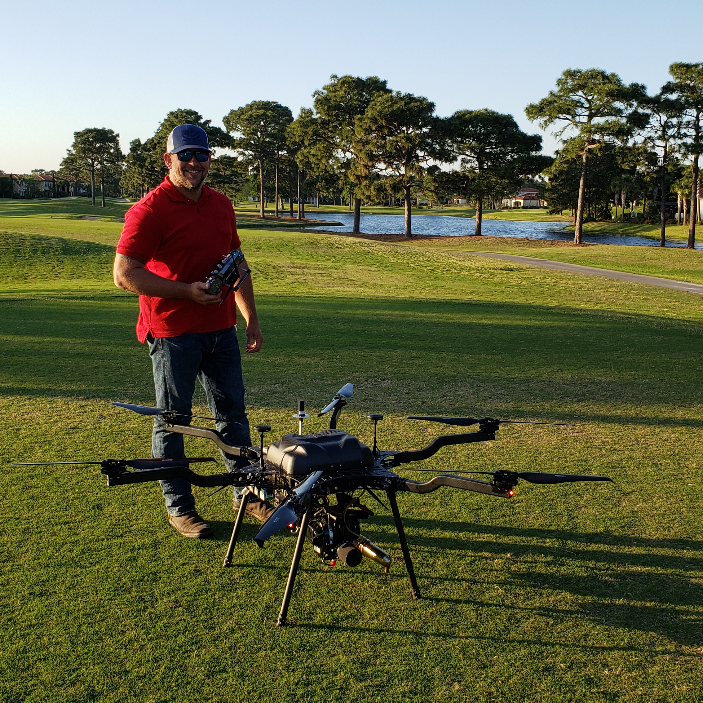
Chief Pilot with Harris Aerial H6 Hybrid

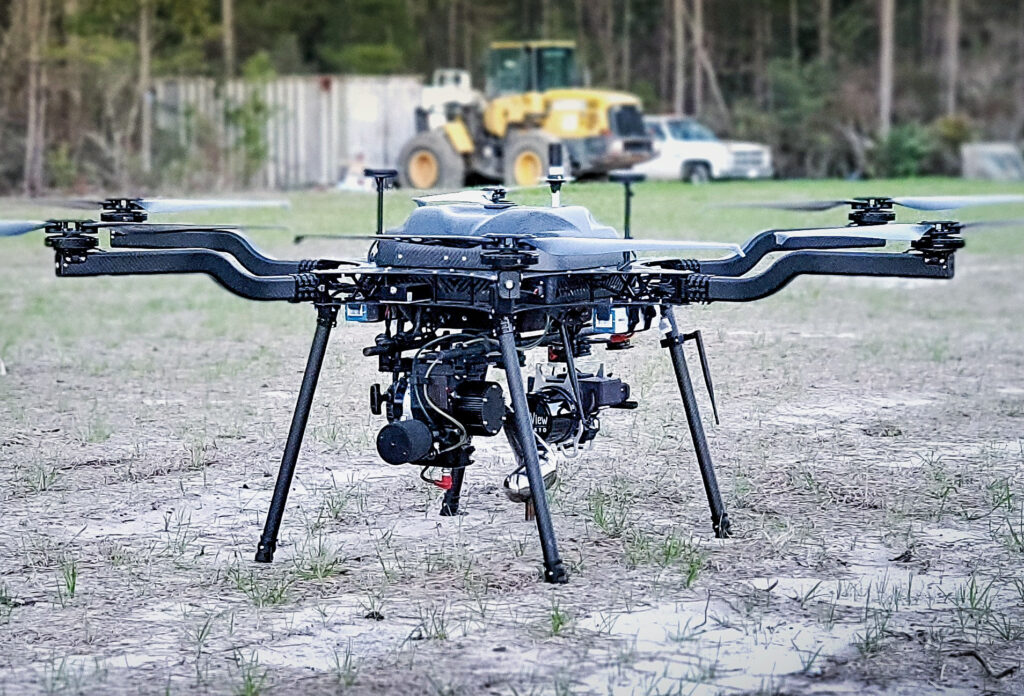
One of the main advantages of using NCT for LiDAR collection is our ability to stay airborne for extended periods of time. Our team has imparted a great deal of effort to identify a hybrid system that would allow for greater single flight capabilities while also meeting the stringent security specifications for Government contracting.

If you need a quote for an Aerial Data Acquisition project, we would be happy to help.  Please click the button below.

Technology

Harris Aerial H6 Hybrid

The Carrier H6 Hybrid is our heavy-lift gas-electric hybrid drone powered by the H2400 (Carrier H6 HE+) Hybrid Drone Generator.

The Carrier H6 Hybrid HE+ is equipped with the H2400 generator providing 2400W of continuous power. The recommended payload is 4kg allowing for up to 2.5hrs of flight. The max payload is 6kg allowing up to 1.5hrs of flight.

The utilization of a hybrid sUAS system along with a high accuracy LiDAR & Mapping system allows NCT to cover more ground per flight and per day.  This collection methodology equates to direct savings to the customer.

It is important to note that this sUAS is manufactured in the USA with components meeting all federal safety and security guidelines allowing for flights within federal airspace and on DOD facilities. 

Autel Evo II DUO

At the heart of the Autel EVO II drone models lies a high-performance efficient processor that gives these drones 6 direction obstacle sensing, 5-mile transmission range, and a whopping 40 minute flight time.

The Autel EVO II drones comes in 3 distinct camera variations. With the large sensor in the Autel 2 Pro easily create 3D maps of buildings and structures. With the Autel Evo 2 Dual thermal sensor see through smoke and assist with search and rescue missions.

It is important to note that this sUAS is manufactured in the USA with components meeting all federal safety and security guidelines allowing for flights within federal airspace and on DOD facilities. 

DJI Mavic 2 Pro

The Mavic 2 Pro from DJI is a drone that balances power, portability, and professional-quality visuals with the inclusion of a 20MP Hasselblad L1D-20c gimbal camera. The camera delivers a 1″ CMOS sensor with an adjustable f/2.8 to f/11 aperture, support for a 10-bit Dlog-M color profile, and 4K 10-bit HDR video capture.

The Mavic 2 Pro utilizes a low-drag aerodynamic body design for achieving speeds up to 47.7 mph, a four-cell LiPo battery for up to 31 minutes of flight time, and low-noise propellers for filming without being distracting. This power and performance are coupled with a variety of dynamic shooting modes and other capabilities that help you achieve cinematic results.

TrueView 515 LiDAR and Mapping Sensor

The True View® 515 is GeoCue’s latest addition to our LIDAR/camera fusion platform designed from the ground up to generate high accuracy 3D colorized LIDAR point clouds.

Featuring dual GeoCue Mapping Cameras, Hesai PandarXT-32 laser scanner and Applanix Position and Orientation System (POS), the result is a true 3D imaging sensor (3DIS). With its wide 120° fused field of view, the True View 515 provides high efficiency 3D color mapping and will redefine LIDAR wire extraction and dense vegetation penetration applications for all- purpose grade sensors.

It is important to note that this sensor is manufactured in the USA with components meeting all federal safety and security guidelines allowing for flights within federal airspace and on DOD facilities.